


di Chiara Testoni
Few concepts have permeated the history of urban planning as persistently as the notion of the ideal city.
From Plato's imagined polis in the Republic to contemporary smart cities, urban thought has been driven by the aspiration to design places that improve collective life. However, as Paul Claudel wrote in La Ville, when humanity attempts to build paradise on earth, the result can resemble hell.
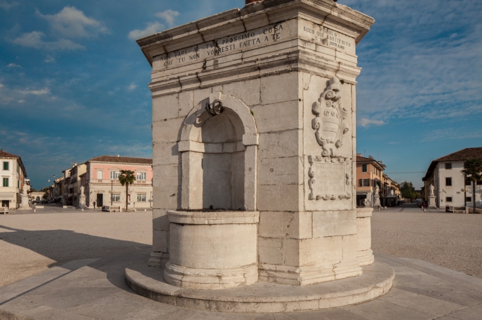
During the Renaissance, this aspiration was grounded in geometry as a form of philosophical and scientific legitimacy. In the treatises of Leon Battista Alberti, Francesco di Giorgio Martini, and Filarete, the city was conceived as a rational, complete, and balanced organism—a physical mirror of a superior political, economic, and moral order. From the unrealized utopia of Sforzinda to the brick-and-mortar realizations of Pienza, Sabbioneta, and Palmanova, the urban ideal was given a tangible, lasting form.
With the Industrial Revolution, mass urbanization and pollution forced a new spatial compromise between nature and the built environment, giving rise to the garden city model, which would deeply influence later new towns, garden suburbs, and satellite cities. In the 20th century, the ideal city shifted into a pragmatic tool for economic development, social engineering, and ideological projects. This became the era of the company town, built from scratch by enlightened, philanthropic entrepreneurs who combined industrial efficiency with collective well-being—as seen in New Lanark in Scotland, or Crespi d’Adda and Ivrea in Italy—eventually giving way to post-war experimental neighborhoods and early ecological utopias.
Today, amid a pressing climate crisis, social hyper-complexity, and new proximity models, the concept of a city bound to a unified, definitive master plan feels increasingly fragile. These uncertainties have catalyzed a season of contemporary experimentation where the city is no longer approached as a fixed architectural artifact, but rather as an evolving process—a shift epitomized by Carlos Moreno’s widely discussed “15-minute city” framework.
Domus has selected seven Italian sites that, across different centuries and ideological landscapes, attempted to build the ideal city, proving that every era inevitably redefines its own definition of perfection.
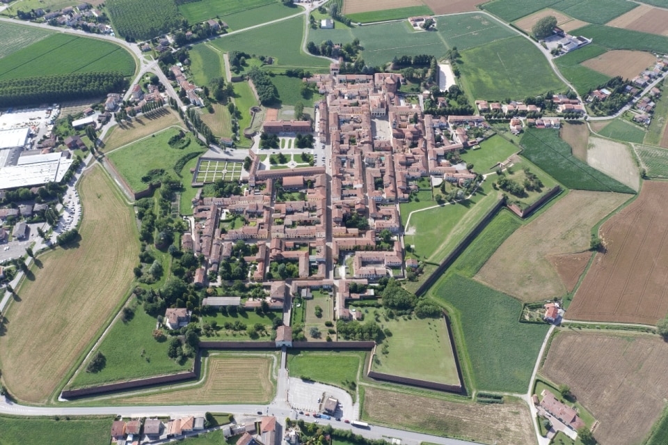
Sabbioneta was founded between 1556 and 1591 by the will of Prince Vespasiano I Gonzaga, who conceived it as the capital of his tiny sovereign state and a tangible manifestation of his political, cultural, and military ambitions. Strategically positioned between the Po Valley plain and the main river trade routes of the mid-Po, the town was designed as a defensive bulwark but functioned primarily as a sophisticated urban laboratory for testing the humanist principles of the ideal city. Unlike most European historic centers, which evolved through centuries of incremental stratification, Sabbioneta is the product of a singular, unified vision executed in just over thirty years, tightly integrating architecture, infrastructure, and public space.
Enclosed within a star-shaped, bastioned defensive wall wrapped by moats, the urban layout is organized around a rigorous orthogonal grid derived from the Roman castrum, divided into 36 regular blocks. The city’s geometry is never a purely formal whim; it is a rigid tool used to organize urban functions, civic hierarchies, and flows, intentionally connecting the palaces of power with the public squares, representative spaces, and the main city gates. The result is a compact, highly legible, and architecturally coherent urban organism, where the dialectic between solid architecture and open space is governed by a precise balance of proportions and perspective axes. The architectural program features some of the most extraordinary landmarks of the late Italian Renaissance, including the Palazzo Ducale, the Palazzo del Giardino, the Galleria degli Antichi, and the Teatro all’Antica. Designed by Vincenzo Scamozzi, the latter stands as the first freestanding, purpose-built indoor theatre in Europe in the modern era. Inscribed onto the UNESCO World Heritage List in 2008 alongside nearby Mantua, Sabbioneta remains one of the most structurally intact examples of a Renaissance ideal city in Europe.
Pienza stands as one of the most iconic examples of a Renaissance ideal city and represents one of the earliest recorded cases of monumental urban regeneration in history. Commissioned by Pope Pius II in 1459 and designed by Bernardo Rossellino—a close collaborator and disciple of Leon Battista Alberti—the “City of Pius” was not built from scratch, but rather born from the radical transformation of Corsignano, the Pope’s modest medieval birthplace, rewritten through the humanist lenses of order, harmony, proportion, and mathematical rationality.
Despite working within a pre-existing medieval urban fabric, Rossellino introduced a radical reorganization of public space where architecture, perspective, and the Tuscan landscape merge into a unified scenery. The focal point of the entire master plan is Piazza Pius II, around which the key structures of civic and religious authority are harmoniously clustered: the cathedral, the bishop’s palace, the town hall, and Palazzo Piccolomini (the latter serving as a foundational archetype for subsequent suburban Renaissance villas).
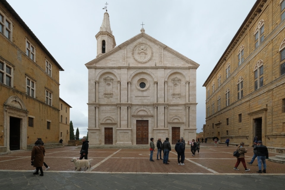
The trapezoidal shape of the square is a brilliant design device rather than a formal caprice; it was engineered to correct the spatial perception of a tight, cramped site, artificially amplifying its depth via an anti-perspective optical effect. By placing the cathedral on the long side of the trapezoid, opposite the natural vanishing lines from the observer’s entry point, the church appears far more monumental, commanding the square. The project’s unified approach is particularly emblematic because, alongside the aristocratic palaces and representative monuments, it incorporates an early ancestor of public social housing: the twelve case nuove (new houses) designed by Pietro Paolo del Porrina in 1463 in the north-eastern district of the town. These were directly commissioned by the Pope to house low-income families who had been displaced from their homes during the demolition works for the main square. In 1996, the historic center of Pienza was inscribed onto the UNESCO World Heritage List.
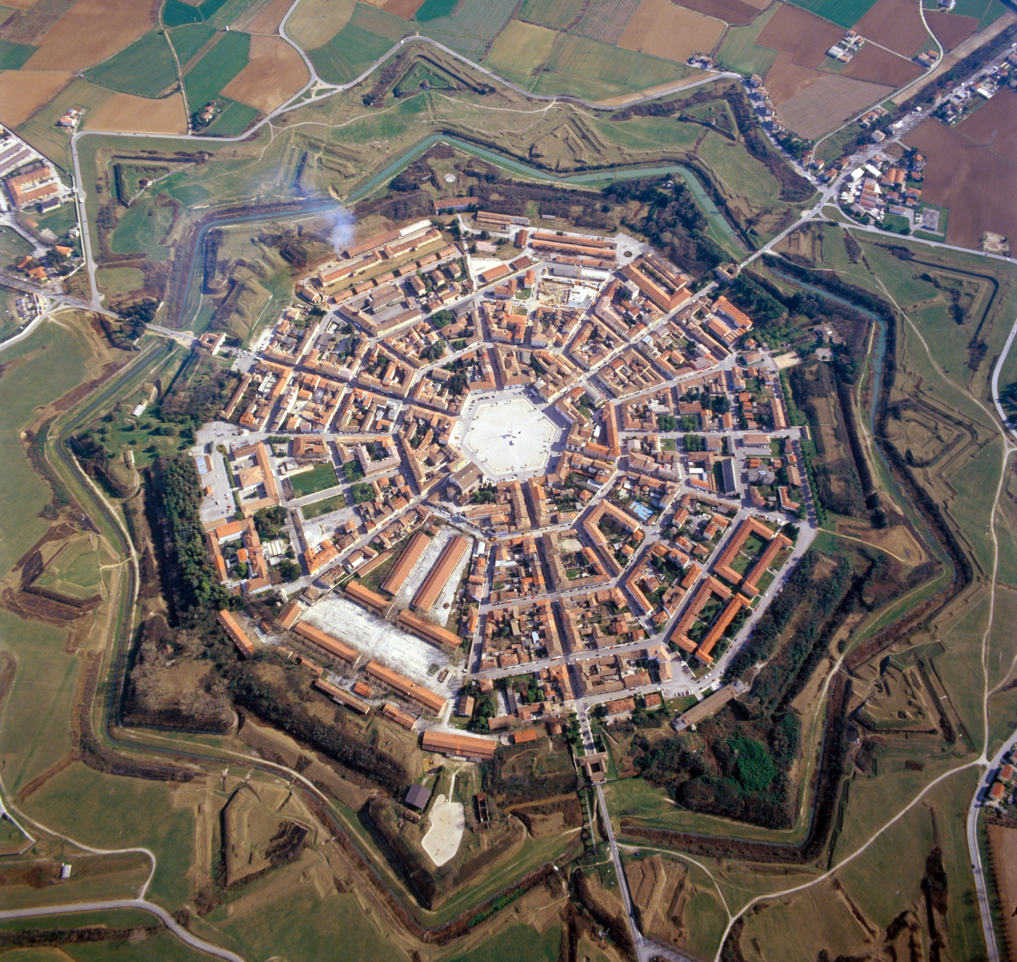
Founded in 1593 by the Republic of Venice, Palmanova represents one of the most complete and radical examples of a città fortezza (fortress city) from the Early Modern period, standing as a textbook application of ideal city theories adapted to advanced military engineering. Conceived as a flawless, highly synchronized “war machine” on the eastern frontier of the Serenissima to counter Ottoman incursions, the city was born as a defensive outpost where strategic parameters, urban discipline, and the representation of state power perfectly coincided within a single geometric blueprint. Its famous nine-pointed star design, which remains remarkably intact to this day, is the structural translation of the trace italienne (fortification alla moderna), developed specifically to withstand the destructive impact of gunpowder artillery.
 View gallery
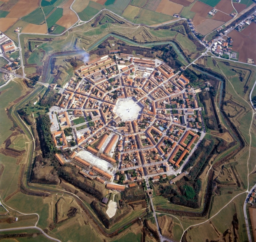


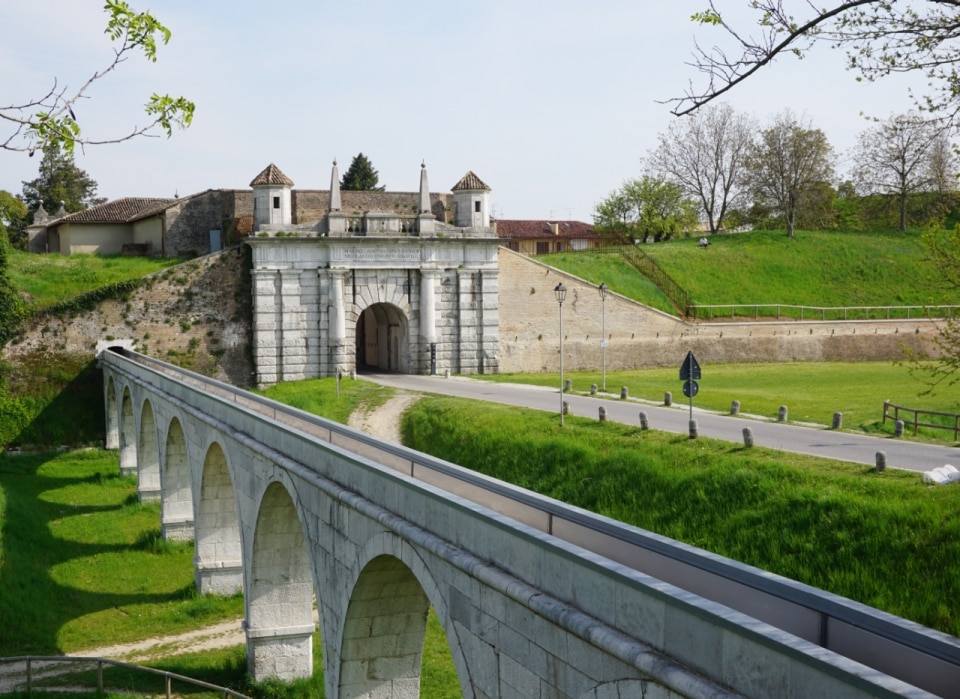
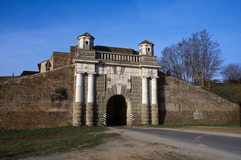
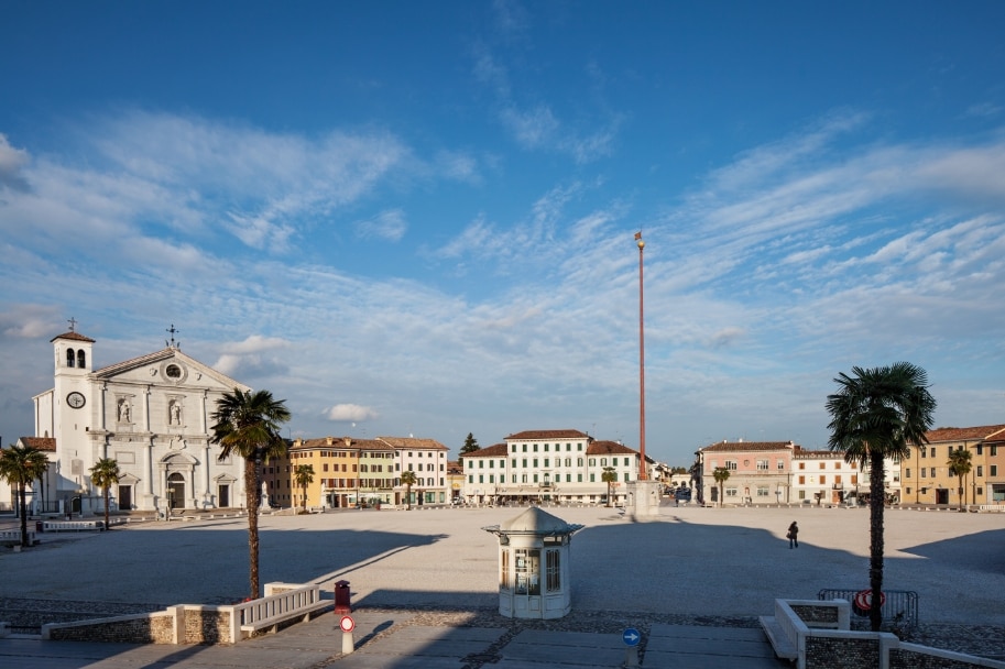
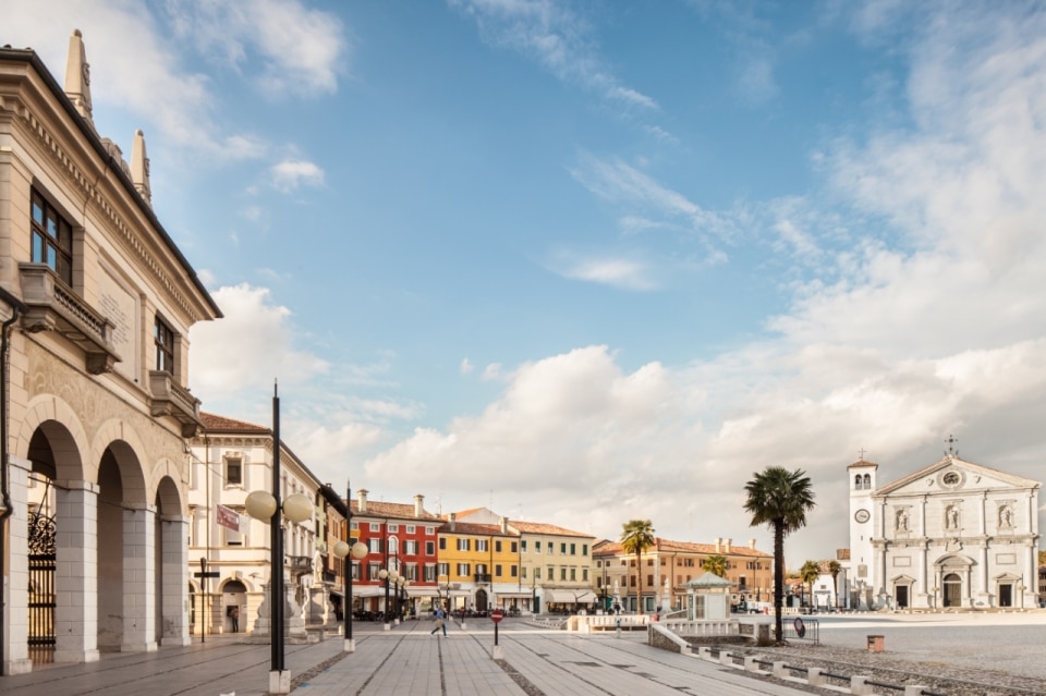
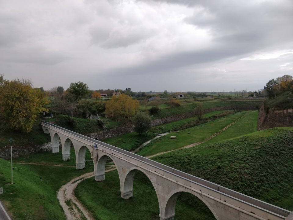
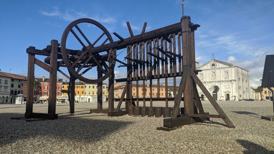
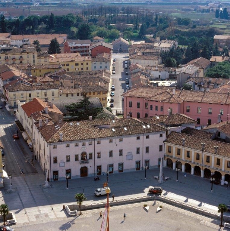
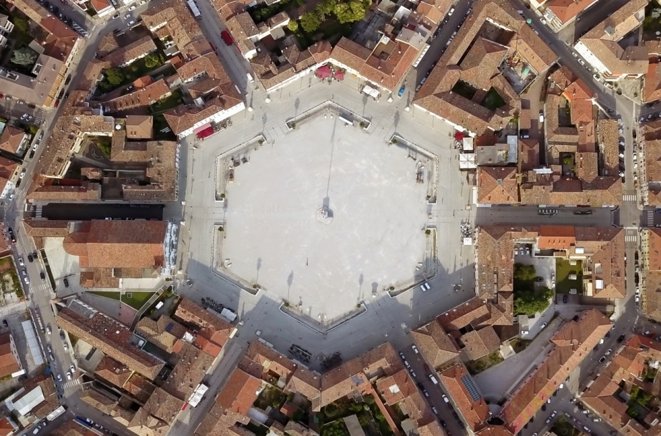
The defensive apparatus consists of three concentric rings of bastions, ravelins, and moats: the first two rings were executed by Venice between the 16th and 17th centuries, while the outermost third ring was completed during the Napoleonic occupation in the early 19th century, sealing the defensive fortress. Inside, an urban layout of concentric ring roads intersected by six primary radial axes divides the city into perfectly symmetric sectors. All radial streets converge toward the central, hexagonal Piazza Grande—the civic, military, and symbolic heart of the community. The entire plan translates the principles of absolute operational efficiency and legibility into physical form: every architectural block and roadway corresponds to a precise spatial hierarchy, optimizing internal troop movements and the rational distribution of public functions. Palmanova was added to the UNESCO World Heritage List in 2017.
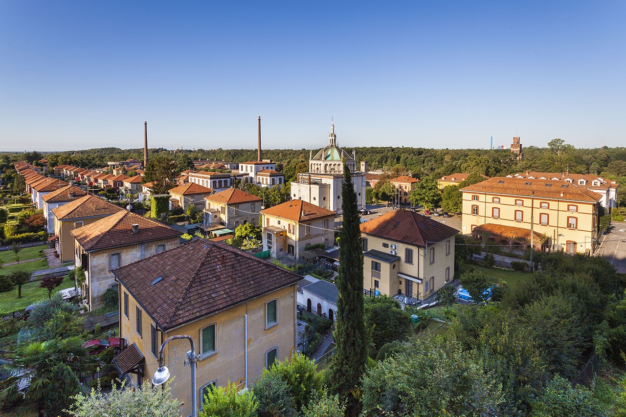
Crespi d’Adda is a major experiment in urban planning where architecture, capitalist enterprise, and social engineering converged into a single territorial master plan, responding directly to the economic and cultural shifts of the Second Industrial Revolution. Founded in 1878 by the industrialist Cristoforo Benigno Crespi and expanded by his son Silvio over the following decades, Crespi d’Adda is one of Europe’s most significant and preserved examples of a company town—a settlement entirely designed, built, and managed by a single manufacturing company to house its labor force.
Rising over an isolated, rural plain bounded by the Adda River and situated adjacent to the family’s textile cotton mill, the settlement integrated production spaces, domestic life, and civic services into a singular urban organism. This paternalistic model sought to blend industrial efficiency, strict social control, and an undeniable improvement in the daily living conditions of the working class. The master plan is defined by a clear, unyielding spatial hierarchy, with the massive factory serving as the productive nucleus around which the rest of the village is symmetrically deployed. A regular matrix of tree-lined avenues organizes the settlement, separating the industrial zones from domestic and communal areas.
 View gallery
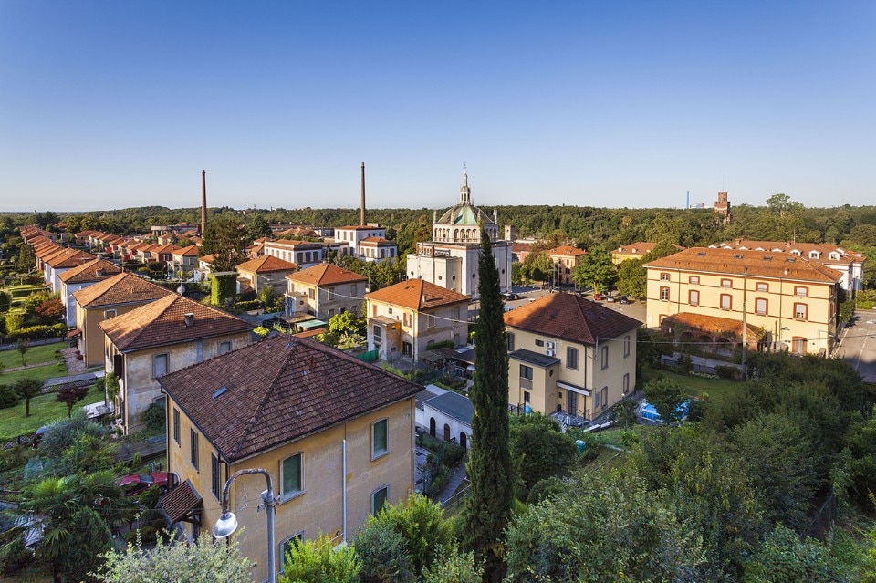
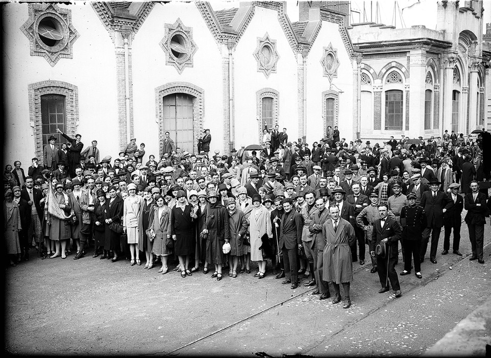
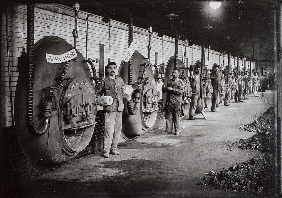
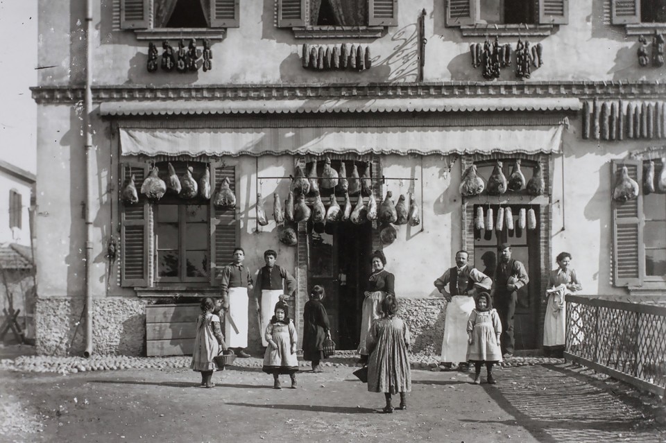
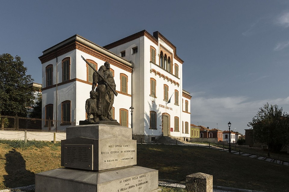
The residential typologies—mostly single-family or semi-detached cottages, each paired with a private vegetable garden and yard—offered a sanitary, revolutionary alternative to the overcrowded, high-density tenement blocks characteristic of European industrial cities, ensuring better hygiene and a higher quality of life. The master plan also provided an advanced ecosystem of communal amenities: a school, a church, a hospital, a theater, public baths, an after-work social club (dopolavoro), a cemetery, and sports fields.
These were conceived as structural parts of the town, engineered to foster a stable, self-sufficient, and loyal community. Following the gradual decommissioning of the manufacturing plant during the 20th century, the village preserved its original layout almost entirely intact. Today, it remains a living community, often inhabited by the direct descendants of the original factory workers. Since 1995, Crespi d’Adda has been protected as a UNESCO World Heritage Site.
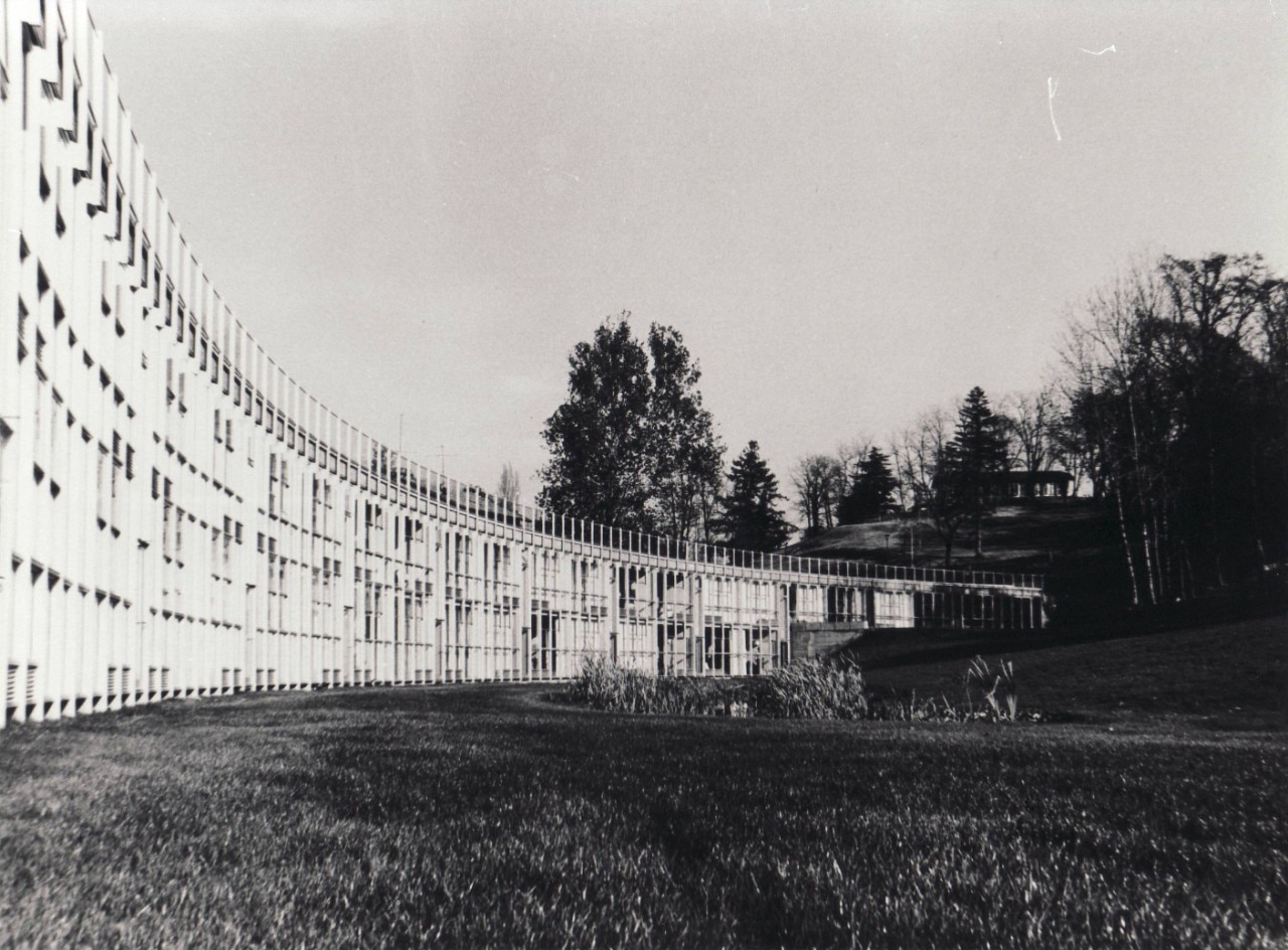
The ideal industrial city of Ivrea took shape primarily between the 1930s and the 1960s, expanding outward from the core of the Borgo Olivetti, a residential quarter built in the 1920s around the typewriter factory founded by Camillo Olivetti. Under the visionary leadership of his son, Adriano Olivetti—who assumed direction of the firm in 1938—the urban project radically widened its horizons beyond the traditional boundaries of an industrial settlement, turning the entire city into an open architectural laboratory. Here, architecture, mass production, modern culture, and social welfare were handled as interdependent components of a single urban system.
The goal was not merely maximizing factory output, but cultivating a community rooted in a careful equilibrium between private enterprise and social democracy, technological acceleration and humanistic quality of life. Industrial workspaces were re-engineered as bright, glassy environments open to the surrounding Piedmontese landscape, intentionally designed to enhance the physical and psychological well-being of the workers. Concurrently, a capillary network of corporate services—including public libraries, cafeterias, modern kindergartens, cultural centers, free medical care, and specialized training programs—pioneered a sophisticated model of corporate welfare decades ahead of its time.
 View gallery
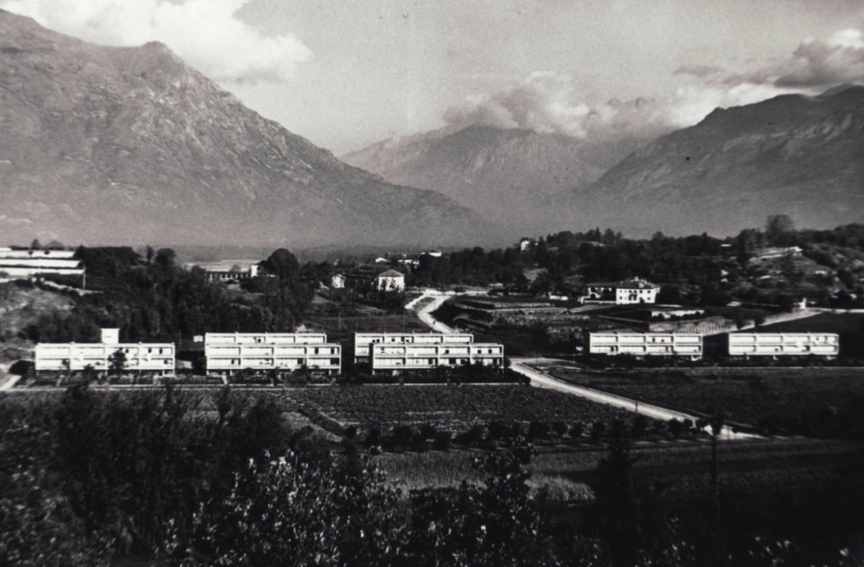

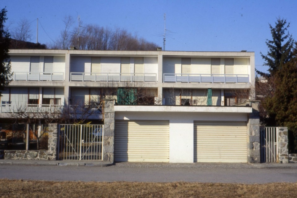



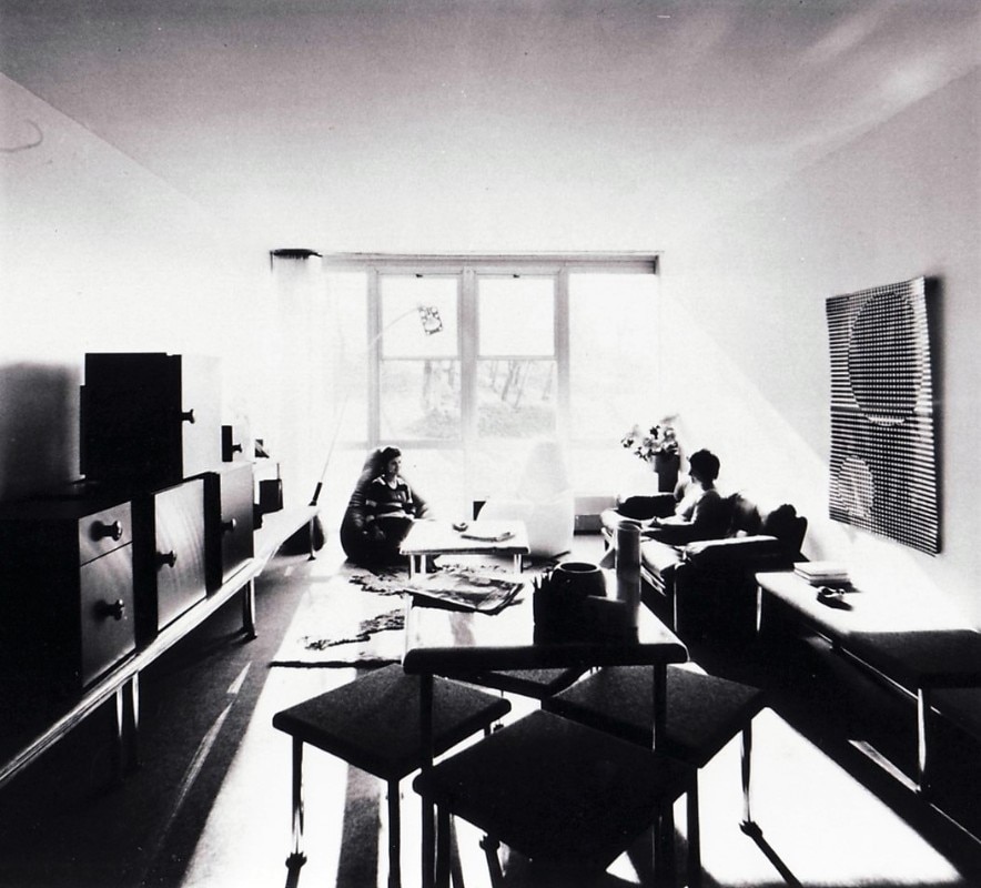
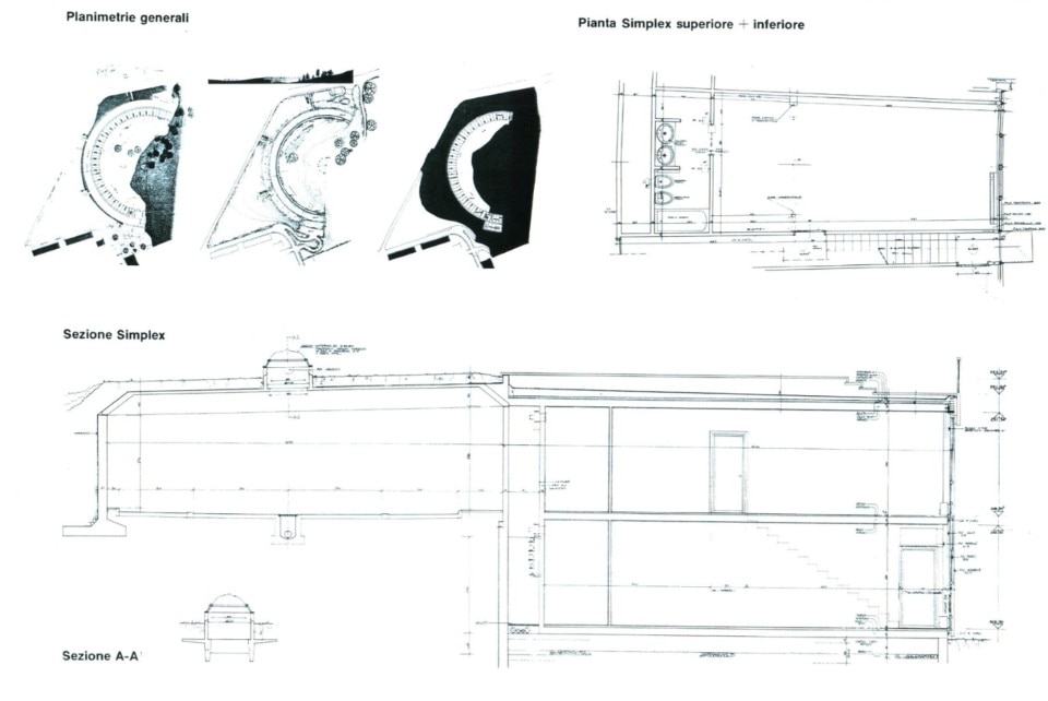
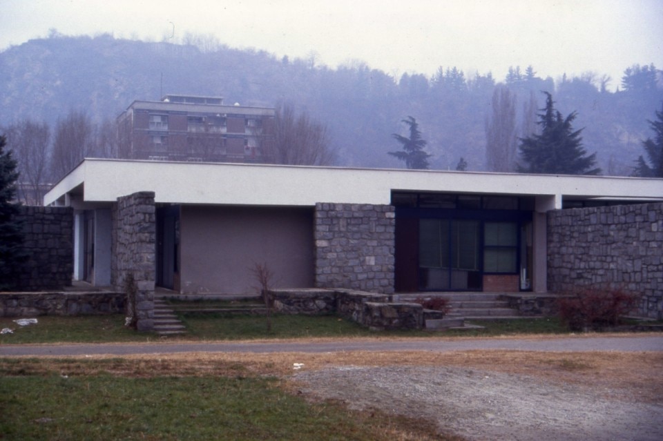
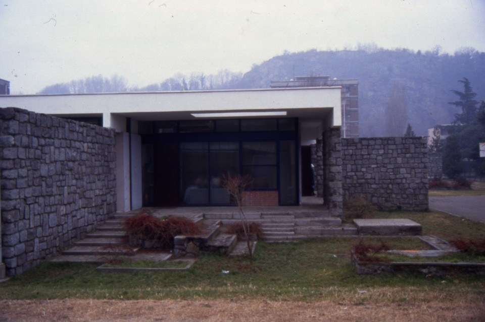
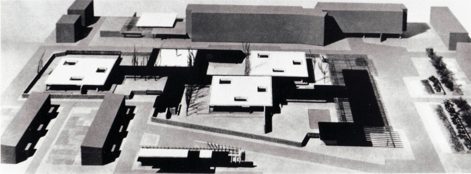
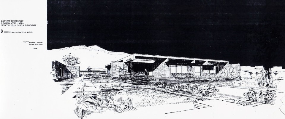
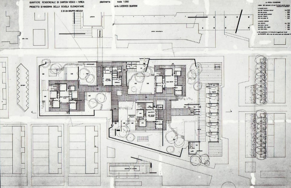
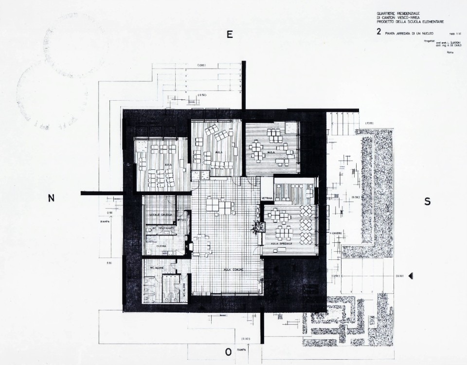
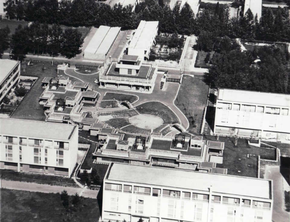


Between the 1940s and 1960s, Olivetti gathered a stellar constellation of Italy’s mid-century design and architectural avant-garde to Ivrea, sparking a continuous dialogue between structural innovation, residential research, and environmental sensitivity. Among the most iconic architectural interventions are the office buildings, workshops, and employee housing designed by Luigi Figini and Gino Pollini; the sculptural, semi-subterranean Talponia residential complex by Roberto Gabetti and Aimaro Isola; the rationalist corporate cafeteria and recreation center by Ignazio Gardella; and the striking architectures of Eduardo Vittoria, along with dozens of other architects, urban planners, and designers. In 2018, Ivrea was recognized as a UNESCO World Heritage Site under the title “Ivrea, industrial city of the 20th century”.
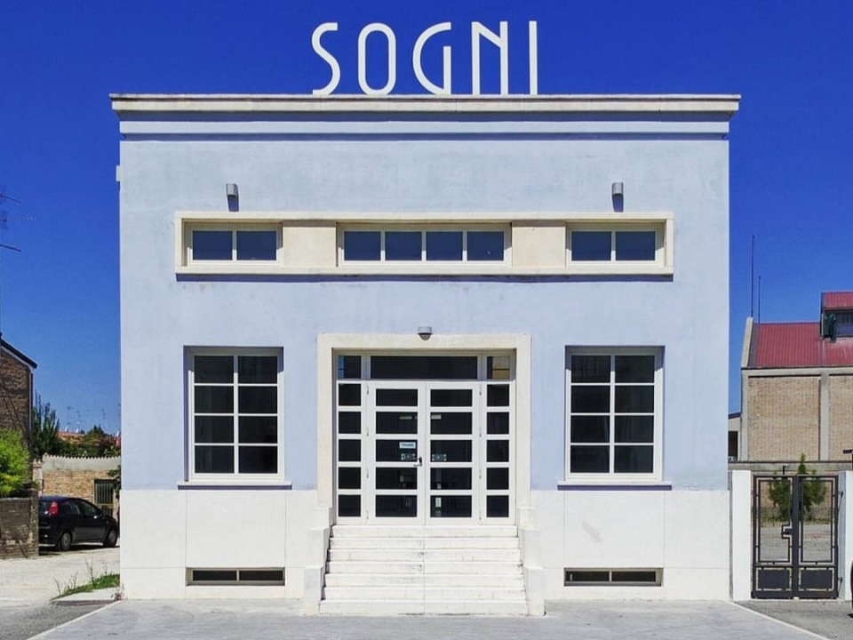
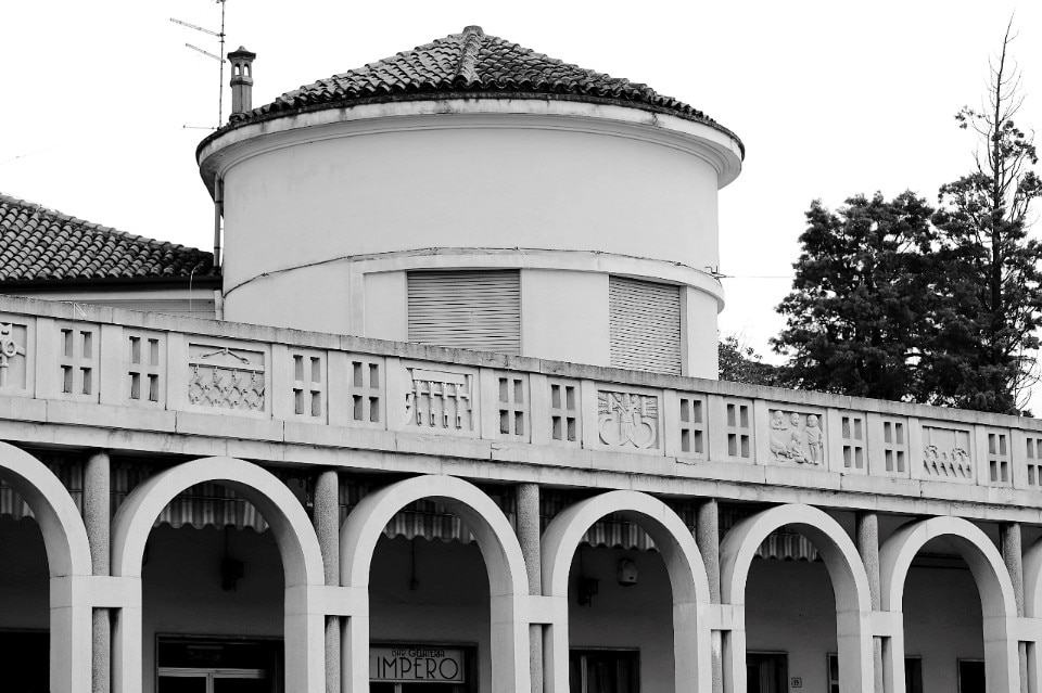
The small town of Tresigallo was radically transformed between 1935 and 1939 under the driving impulse of Edmondo Rossoni, a powerful Fascist politician native to the Ferrara countryside who served as the Minister of Agriculture and Forestry in the Mussolini regime. The project was explicitly designed to transform a forgotten, impoverished agricultural hamlet in the Emilian plain into a utopian model town embodying the socio-economic doctrines of Fascist corporatism. The intervention was a key component of the wider territorial and economic reorganization policies championed by the regime during the 1930s, seeking to establish a planned hub capable of seamlessly linking agricultural production, modern industrial processing, and civic services into a self-sufficient, autarkic system.
.JPG.img.png/1682606881664.png) View gallery
View gallery
.JPG.foto.rmedium.png)
.JPG.foto.rmedium.png)
.JPG.foto.rmedium.png)
.JPG.foto.rmedium.png)
.JPG.foto.rmedium.png)
.JPG.foto.rmedium.png)
.JPG.foto.rmedium.png)
.JPG.foto.rmedium.png)
.JPG.foto.rmedium.png)
.JPG.foto.rmedium.png)
.JPG.foto.rmedium.png)
.JPG.foto.rmedium.png)
.JPG.foto.rmedium.png)
.JPG.foto.rmedium.png)
.JPG.foto.rmedium.png)
.JPG.foto.rmedium.png)
.JPG.foto.rmedium.png)
.JPG.foto.rmedium.png)
.JPG.foto.rmedium.png)
.JPG.foto.rmedium.png)
Entrusted to the engineer and urban planner Carlo Frighi, the master plan bypassed simple architectural expansion to completely rewrite the town’s visual identity through a unified design heavily inspired by the canons of Italian Rationalism. The new town was structured along a rigorous geometric matrix of orthogonal axes, theatrical public squares, carefully calibrated perspective vistas, and scenic spatial sequences engineered to instill a sense of monumental civic order. Pure geometric volumes, pristine plastered surfaces, stark symmetries, and classical proportional ratios defined a sharp architectural vernacular where rationalist modernity fused with a haunting, metaphysical atmosphere. The corporate layout was underpinned by a comprehensive network of public buildings and civic infrastructure, which included schools, worker housing, sports facilities, urban parks, and dedicated social welfare venues—ranging from a specialized sanatorium and a theater to a centralized agricultural processing complex and a women’s embroidery institute.
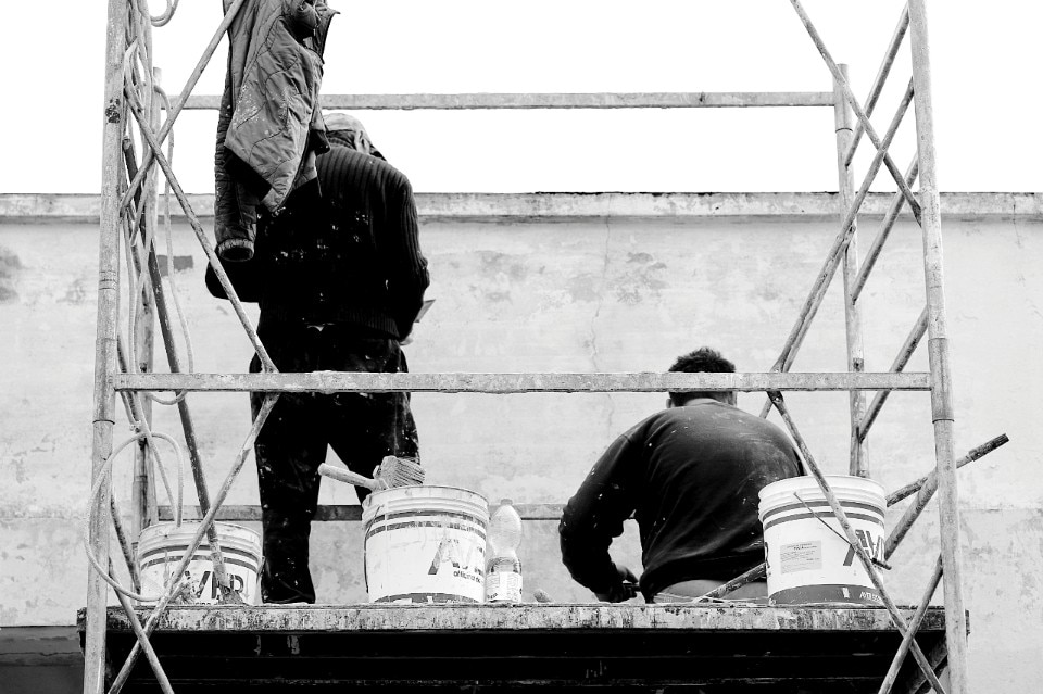
However, this total political and ideological blueprint remained partially unfulfilled, cut short by the outbreak of World War II and the post-war restructuring of the rural economy. As industrial processing activities ceased and public spaces were gradually decommissioned, the settlement entered a prolonged phase of urban decline. This trajectory shifted in the 1990s, when a series of targeted architectural restorations, adaptive reuse programs, and cultural revitalization initiatives refocused international attention on its rationalist heritage. Today, the town stands as a primary case study in the critical preservation and contemporary reinterpretation of Interwar rationalist urban planning.
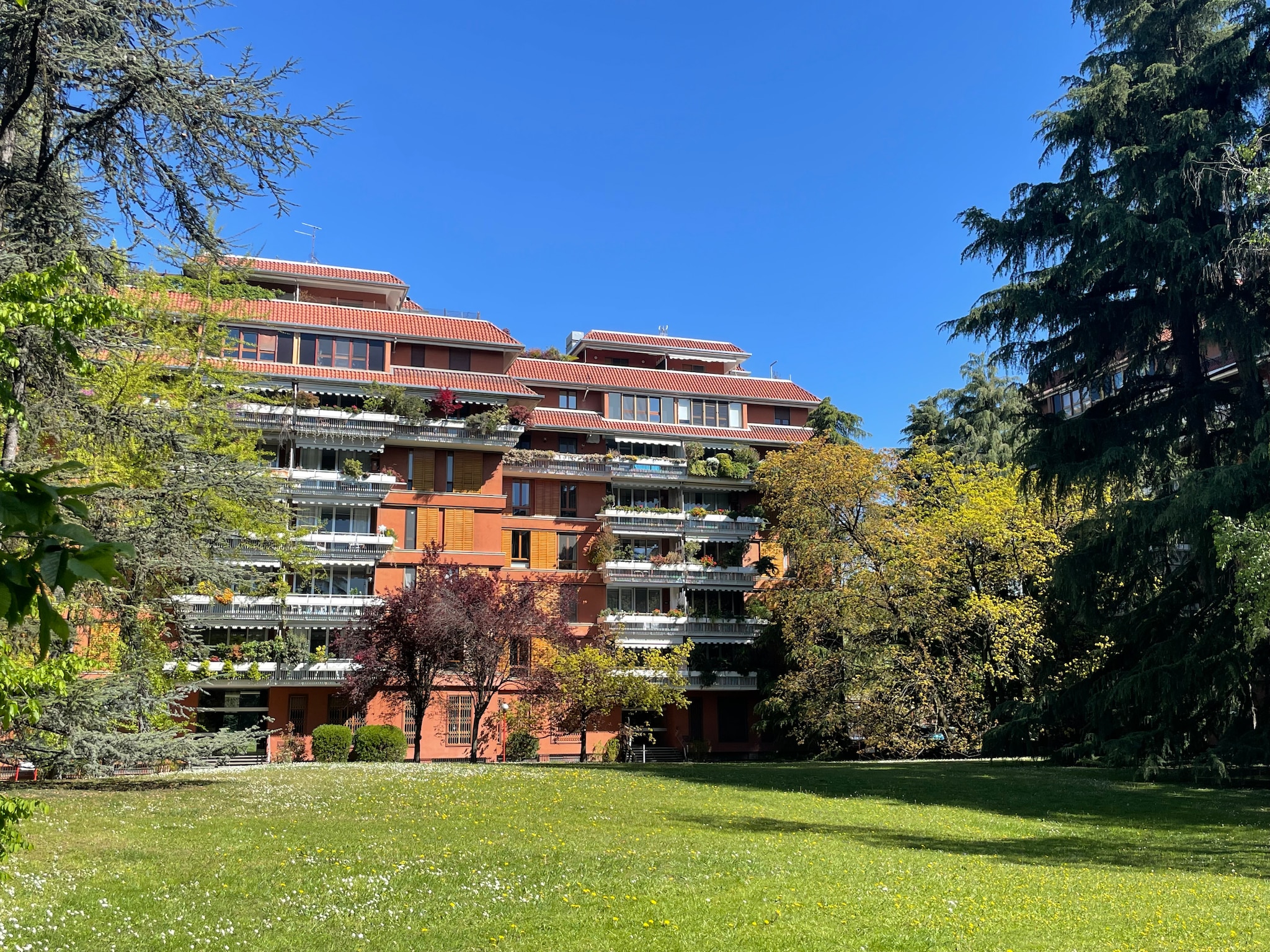
Drawing directly from the legacy of the Ebenezer Howard garden city tradition and the suburban residential typologies that gained traction across 20th-century Europe, two of Italy’s most significant planned residential developments emerged within the Milanese hinterland during the late 1970s and early 1990s: Milano 2 in Segrate (constructed between 1974 and 1980) and Milano 3 in Basiglio (developed between 1980 and 1991). Promoted by Silvio Berlusconi through his real estate group Edilnord and designed by the architect Giancarlo Ragazzi in close collaboration with Giuseppe Marvelli, these twin developments were explicitly marketed as a clean, structured alternative to the historical city center and the dense, chaotic post-war peripheries, which were increasingly plagued by traffic congestion and a lack of public space.
 View gallery
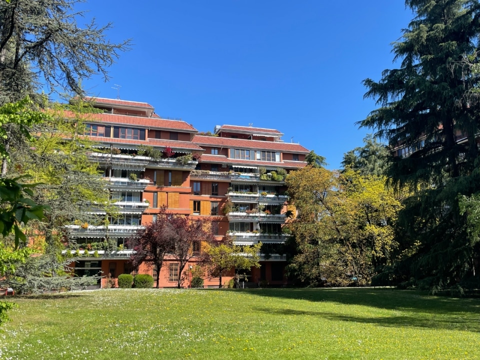
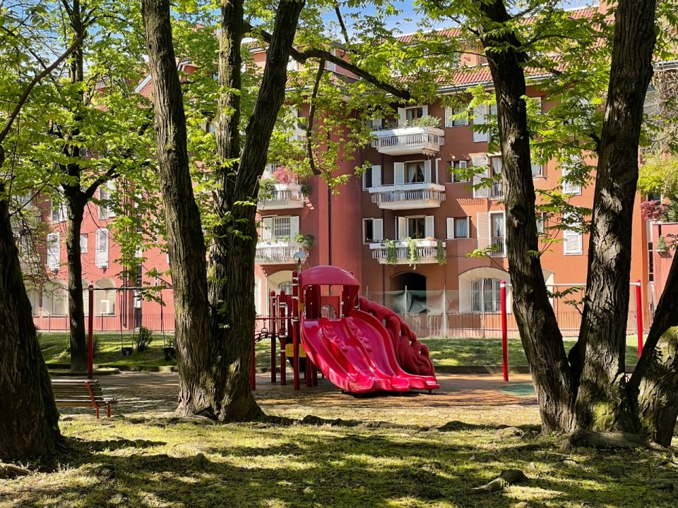
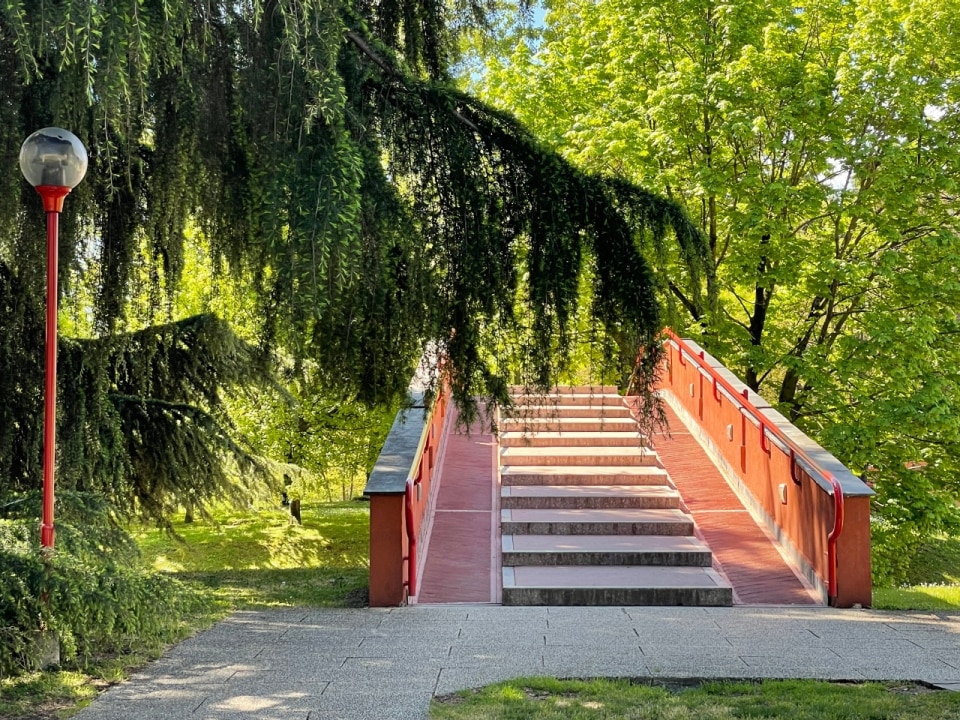
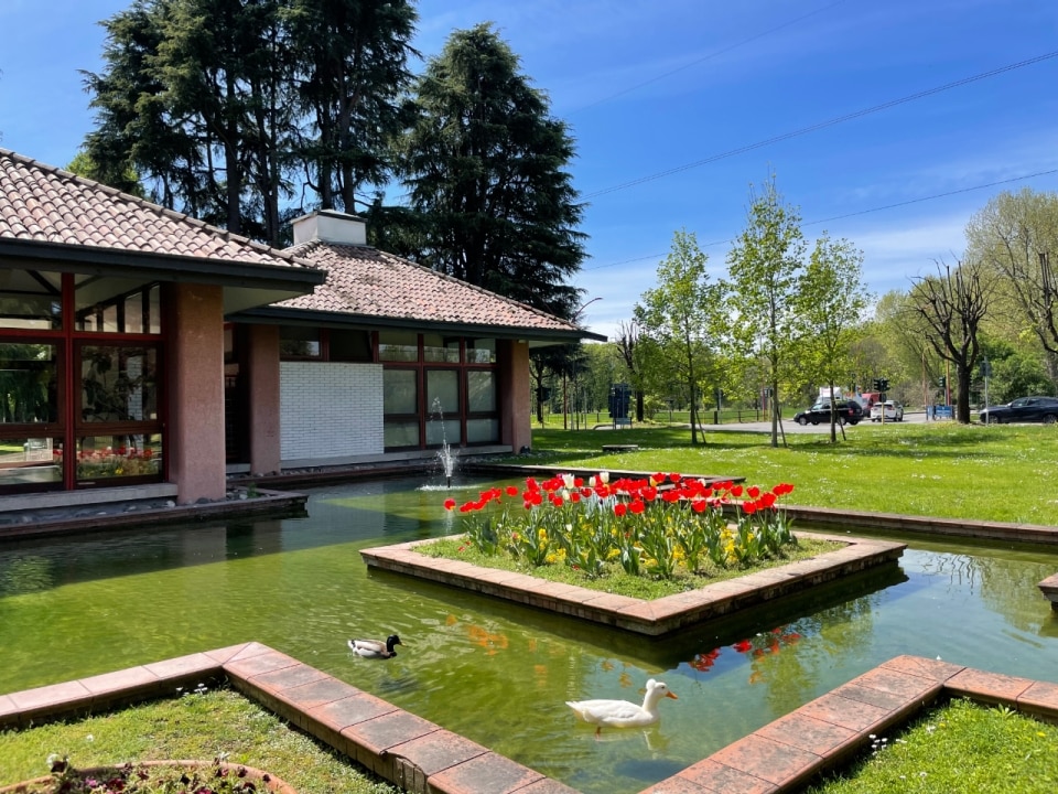
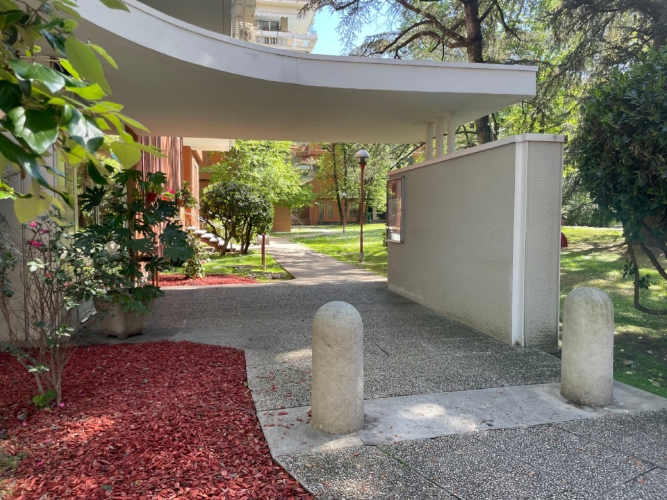
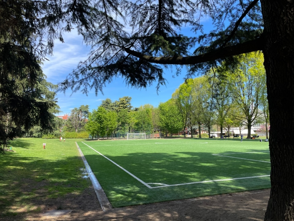
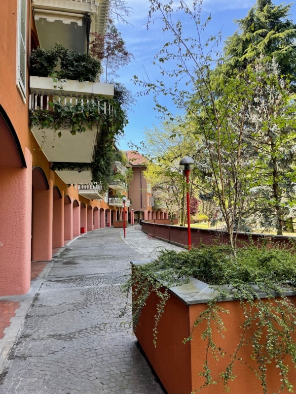
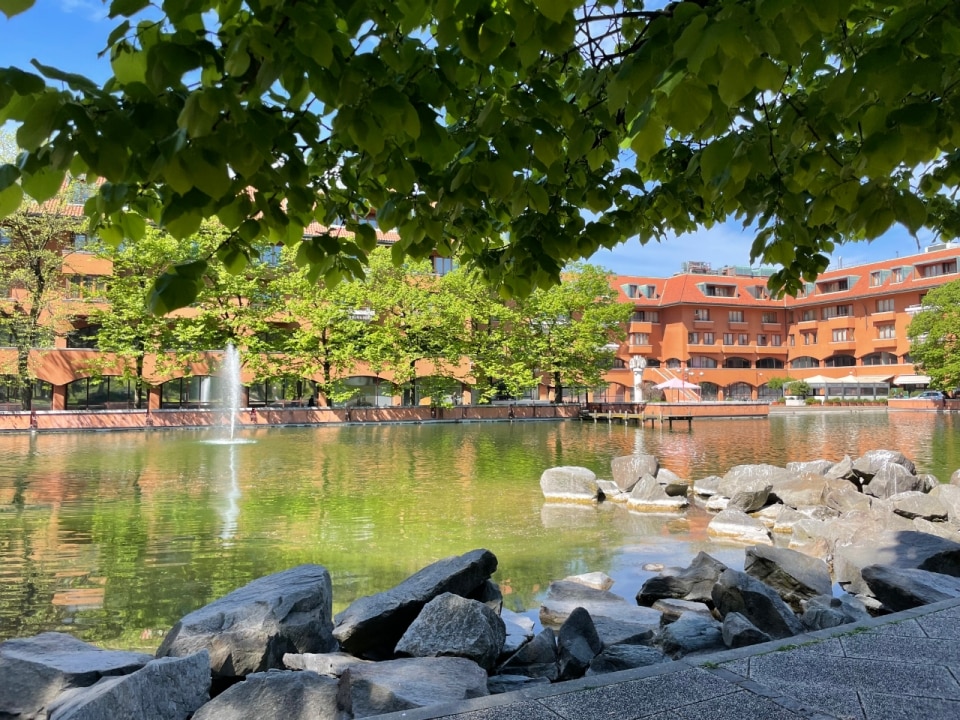
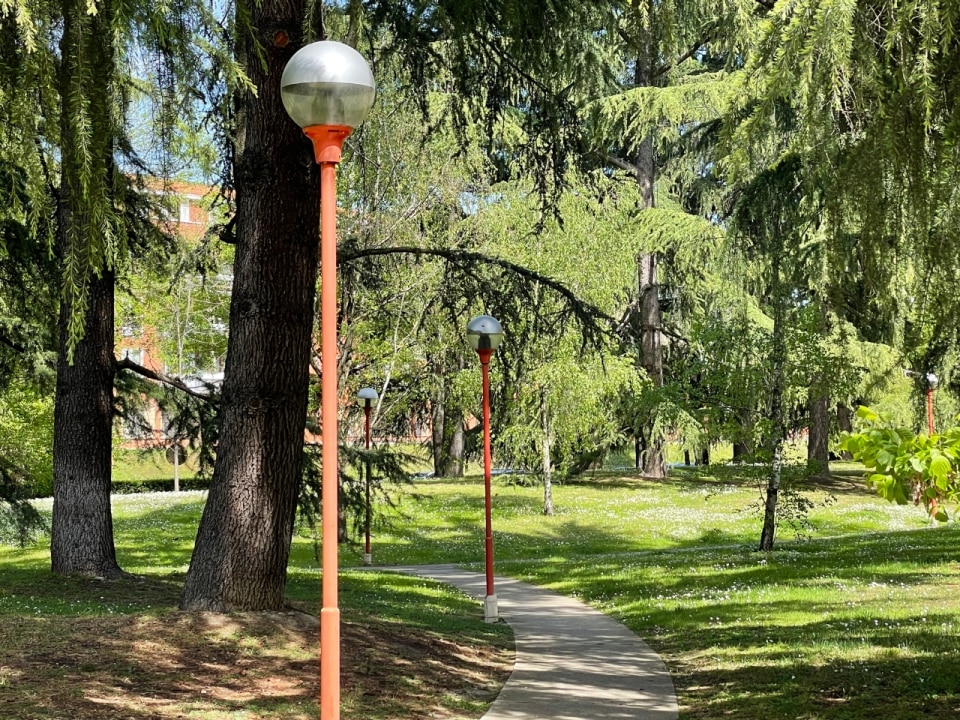
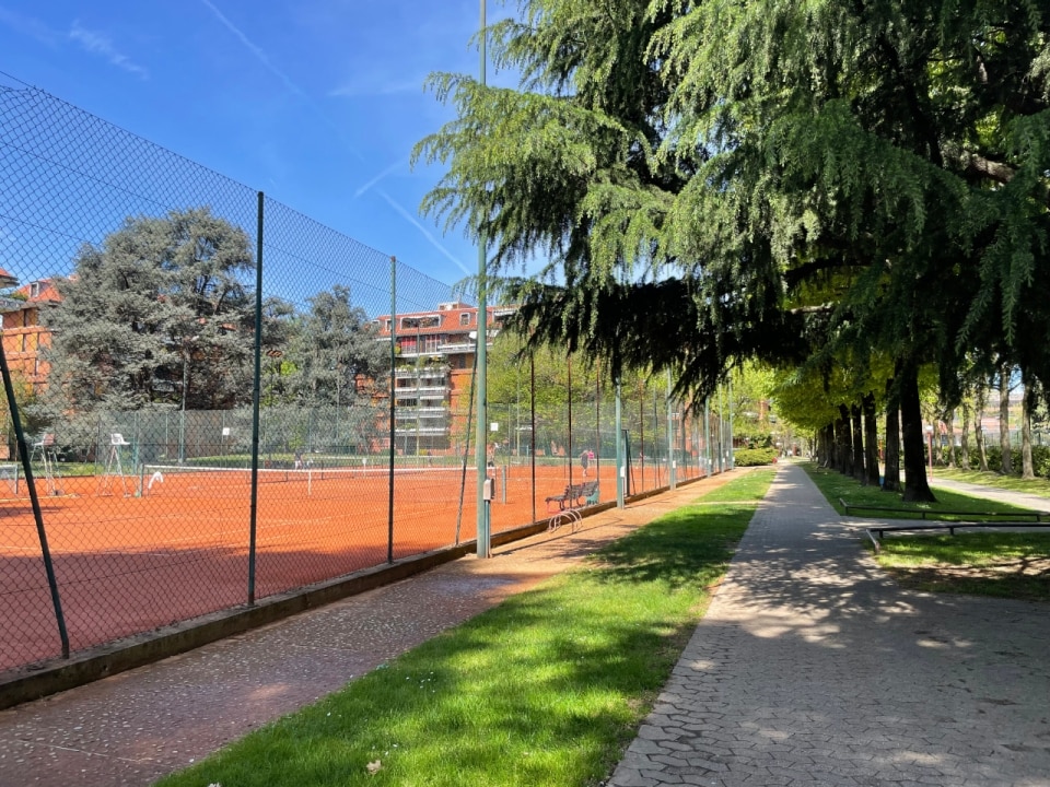
Both districts were conceived as self-contained, exclusive residential enclaves governed by an introverted spatial logic. Their defining feature is a complete, uncompromising separation of automobile infrastructure from pedestrian and bicycle traffic, using an intricate internal network of pathways to prioritize slow mobility and safety. Architecturally, both interventions maintain a strict typographic and stylistic homogeneity: low-to-mid-rise residential apartment blocks arranged to maximize open views, creating a fluid continuity between the domestic interior and the surrounding greenery.
The primary innovation lies in the landscape design, which was treated as a primary piece of urban infrastructure rather than a decorative afterthought, effectively delivering on the marketing promise of “living in the countryside” while remaining a short drive from the regional capital. Expansive lawns, dense rows of trees, artificial lakes, walking paths, and equipped recreation areas form a continuous green fabric that weaves around the residential structures, assembling a domestic imagery heavily rooted in an Arcadian, secure, and reassuring ideal.
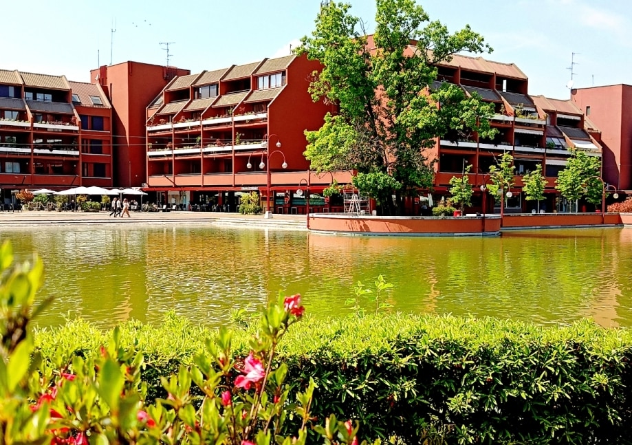
While some critics have hailed these two master plans as pioneering examples of integrated suburban planning that anticipated current debates around environmental quality, total pedestrianization, and micro-proximity to services, they have also faced significant criticism for operating as isolated enclaves, intentionally detached and insulated from the wider, surrounding metropolitan fabric.
Opening image: Tresigallo, Province of Ferrara, Emilia-Romagna, Italy. Photo by Gianluca Bertoncelli via Flickr