Newtown Creek

A photographic mapping of New York City's industrial backyard.

Newtown Creek: A Photographic Survey of New York's Industrial Waterway, Anthony Hamboussi, Princeton Architectural Press 2010 (432 pp., US $55)

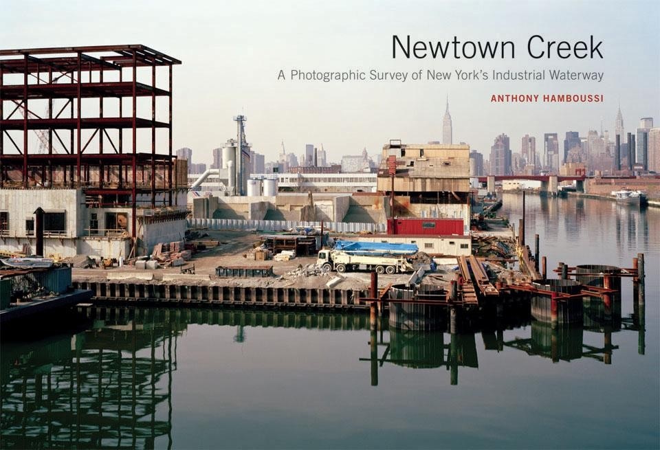
Anthony Hamboussi's photographic survey of New York City's Newton Creek reveals a beautiful and bleak journey into the manufacturing and industrial landscapes that surround the waterway. Flowing into the East River, the canal marks a portion of the border between Queens and Brooklyn. Once one of the most thriving commercial shipping centers in the country, today Newtown Creek's polluted waters appear neglected and desolate, remaining largely unknown to most New Yorkers. Yet, Hamboussi's photos give a glimpse of the life behind the chained fences and windowless façades, subtly unveiling the activity and transformations that otherwise go unnoticed.
Manhattan skyline from Second Street, Hunters Point, Queens, looking northwest. From <i>Newtown Creek: A Photographic Survey of New York's Industrial Waterway </i>by Anthony Hamboussi - Princeton Architectural Press, 2010
Manhattan skyline from Second Street, Hunters Point, Queens, looking northwest. From Newtown Creek: A Photographic Survey of New York's Industrial Waterway by Anthony Hamboussi - Princeton Architectural Press, 2010
A six year project, from 2001 to 2006, the book is ordered chronologically, comprehensively documenting the landscape through over 230 images. Each photo is given a full page, while most spreads juxtapose a single line of text on the left with an image on the right. Flipping through spread after spread, you get a sense of Hamboussi's remarkable insight and the care he devoted to detailing Long Island City, Maspeth, Greenpoint and Bushwick—the neighborhoods that surround the creek. The text is uncomplicated, simply orienting the viewer and locating each photo according to cross streets or addresses. The overall effect is like a non-planar photographic mapping of the infrastructure and industry that exist there—each image a still in Hamboussi's narrative.
J. J. Byrne Memorial Bridge, from Newtown Creek main channel. From <i>Newtown Creek: A Photographic Survey of New York's Industrial Waterway </i>by Anthony Hamboussi - Princeton Architectural Press, 2010
J. J. Byrne Memorial Bridge, from Newtown Creek main channel. From Newtown Creek: A Photographic Survey of New York's Industrial Waterway by Anthony Hamboussi - Princeton Architectural Press, 2010
Infrastructure is omnipresent. Most of the images are taken from the street—the infrastructure literally foregrounded—while others frame the expressways, the Long Island Railroad, or one of the many bridges that cross Newtown Creek. There is an assumption that something is always moving.

Although remarkably not a single person can be found in the images throughout the book, rather than seeming vastly deserted, these spaces seem active; you might assume that everyone is out to lunch. Trucks are parked outside warehouse doors, waiting to make their deliveries. Cranes are perched in the backgrounds, alluding to the destruction or construction of something new. In general, there is a sense that transformation is underway. Some images depict the derelict relics of industries long gone—at this point, nature taking over again as grasses and ivies infiltrate. Yet many of the images show the large amount of new construction that is materializing. Even those of demolished buildings suggest that something new will stand in their place in just a few years.
Hamboussi’s austere and gray images—a result of both the photographer’s preference for overcast skies and the concrete and steel that proliferate—depict a landscape that is easily overlooked, yet can reveal so much about the world we live in.
Pier remains from the Long Island Rail Road swing bridge, Blissville, Queens, looking southwest. From <i>Newtown Creek: A Photographic Survey of New York's Industrial Waterway </i>by Anthony Hamboussi - Princeton Architectural Press, 2010
Pier remains from the Long Island Rail Road swing bridge, Blissville, Queens, looking southwest. From Newtown Creek: A Photographic Survey of New York's Industrial Waterway by Anthony Hamboussi - Princeton Architectural Press, 2010
The city has mapped, de-mapped and re-mapped areas of Hunters Point, as well as along the creek. Properties fluctuate between public and private ownership, as streets die off behind gates or into loading docks. Having ridden a bike through this area, I can attest to the proliferation of dead-ends and turn-arounds. As it continues to change, you can know that, like the rest of the city, further development is not long off. The waterfront along the East River has already begun to site housing and retail developments, and plans for Hunters Point South include a full range of urban amenities.

For now we can appreciate the industry, infrastructure and the resulting aesthetic that exists there currently. Hamoussi's austere and gray images—a result of both the photographer's preference for overcast skies and the concrete and steel that proliferate—depict a landscape that is easily overlooked, yet can reveal so much about the world we live in.

Leigha Dennis currently resides in New York while finishing her Architecture degree at Columbia University.
Shoreline from Newtown Creek main canne. From <i>Newtown Creek: A Photographic Survey of New York's Industrial Waterway </i>by Anthony Hamboussi - Princeton Architectural Press, 2010
Shoreline from Newtown Creek main canne. From Newtown Creek: A Photographic Survey of New York's Industrial Waterway by Anthony Hamboussi - Princeton Architectural Press, 2010

Latest News

Latest on Domus

Read more
China Germany India Mexico, Central America and Caribbean Sri Lanka Korea icon-camera close icon-comments icon-down-sm icon-download icon-facebook icon-heart icon-heart icon-next-sm icon-next icon-pinterest icon-play icon-plus icon-prev-sm icon-prev Search icon-twitter icon-views icon-instagram