The map of the Empire

The North American continent narrated by large thematic maps.

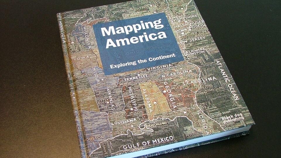
Mapping America. Exploring the Continent, by Frank Jacobs and Fritz Kessler, Black Dog Publishing, London, 2010

"In that Empire, the Art of Cartography attained such Perfection that the map of a single Province occupied the entirety of a City, and the map of the Empire, the entirety of a Province. In time, those Unconscionable Maps no longer satisfied, and the Cartographers Guilds struck a Map of the Empire whose size was that of the Empire, and which coincided point for point with it."
Jorge Luis Borges, Collected Fictions, Translated by Andrew Hurley Copyright Penguin 1999

It appears that Google Maps Street View is creating Borges' paradox: mapping actual territory – more or less on a scale of 1:1. Between writing and describing, it seems that today's preference for video-photography, with its appeal to documentary "truth", is completing the unfinished. Of course, blind spots - areas not yet described - remain; just like the early days of cartography when the map of invention and of discovery filled the visual void by inventing a boundary, an island, "the other:" hic sunt leones. That the possibility of being able to see ourselves from above, of being able to say "we are here," is both knowledge and identity is clear from the patient work of cartographers who have always made the maps, as the places - reduced - of their own and others' conditions, available to the powers that be. But it is also apparent from the overflow of data mapping, from contemporary digital technology which requires specialized knowledge; geographic form often disappears and it becomes necessary to learn how to read the signs and measurements that do not necessarily correspond to traditional geographic coordinates.
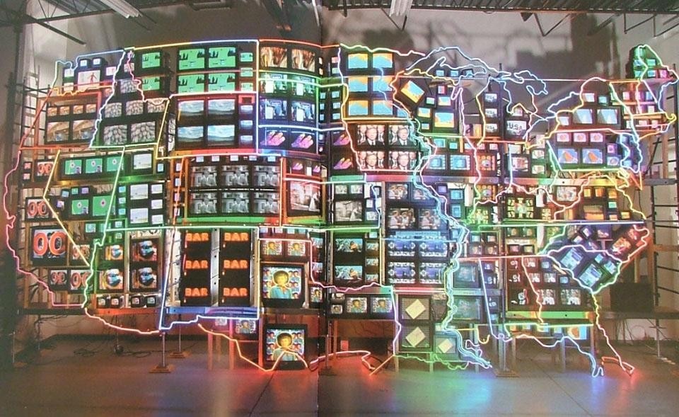
Nam June Paik, <i>Electronic Superhighway</i>: Continental U.S., Alaska, Hawaii, 1995. Image courtesy Smithsonian American Art Museum, Washington D.C./Art Resource, N.Y.
Nam June Paik, Electronic Superhighway: Continental U.S., Alaska, Hawaii, 1995. Image courtesy Smithsonian American Art Museum, Washington D.C./Art Resource, N.Y.
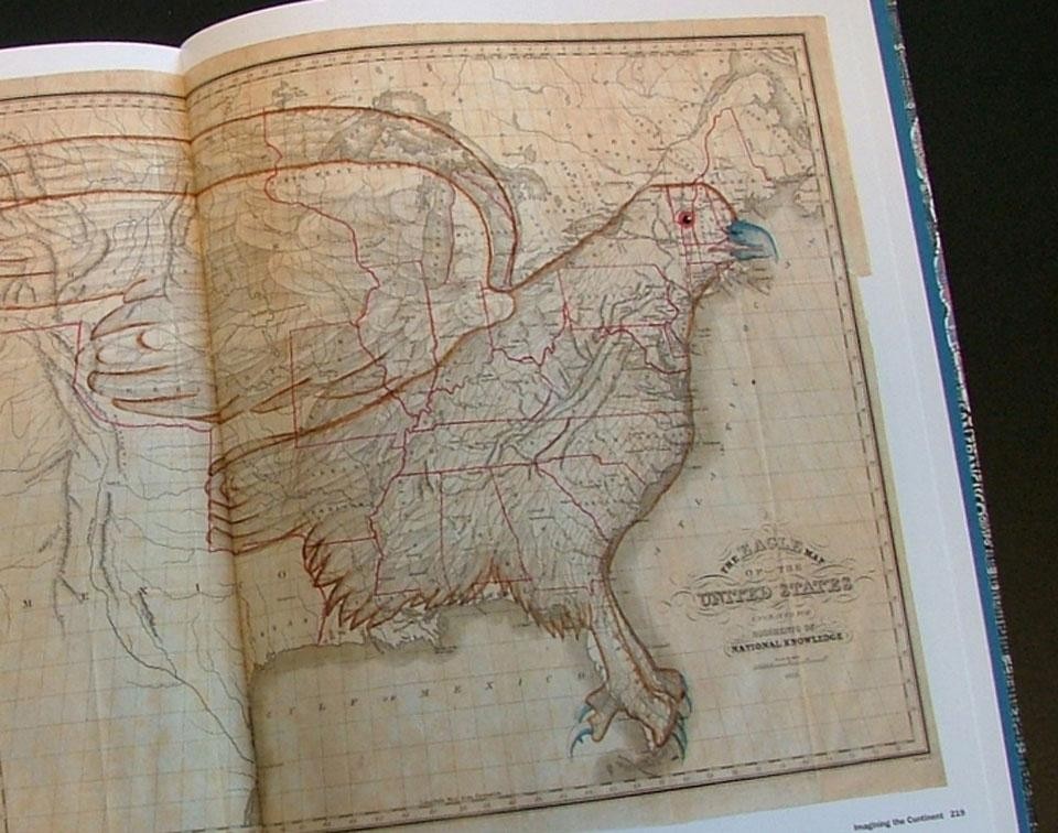
The book, Mapping America, Exploring the Continent, by Frank Jacobs and Fritz Kessler narrates and illustrates this adventure on the North American continent. It does so with stunning large-format color maps organized thematically: symbol, discovery, description, itinerary, imagination. Deliberately non-historical, unconventional maps – such as artistic ones – accompany this choice. But we also encounter other visual curiosities: maps in the form of the human body or an eagle moving from description to visual metaphor. The reader travels mostly between transportation maps of train and bus networks, the postal network, flight routes, between silent maps, historical maps, weather maps, population distribution and density, nocturnal illumination; navigating a fascinating path that finds its common denominator only in the perimeter's form.
Joseph Churchman and James Moore, The Eagle Map of the United States, 1833. Courtesy David Rumsey Map Collection
And these maps are accompanied and punctuated by other, more expressive, maps. Not that the first are not expressive, of course, but the second ones create curious and intriguing juxtapositions. Here (on the cover) is the obsessive map by Paula Scher, a large scale acrylic, or the fluorescent void by Nam June Paik in Electronic Superhighway, 1995. We are already aware of this operation which, present even in museum exhibits, combines and collides archival footage with contemporary artistic expression. We also encounter very personal maps such as Jack Kerouac's map of the trip narrated in On The Road, Winter 1947-'48.
In short, it seems that the authors have decided that the map is point of view and this in two senses: that of one's own position in relation to the object and that, transferred, of opinion.
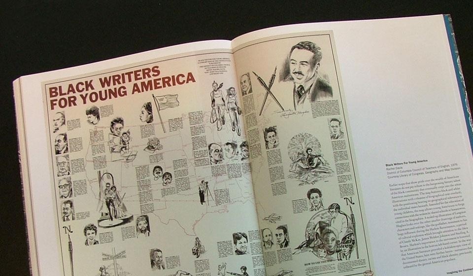
Rachel Davis, Black Writers For Young America, District of Columbia Council of Teachers of English, 1976. Courtesy Library of Congress, Geography and Map Division
Curiously, the book's subtitle contains the word continent which, for us, means united land rather than interrupted land. In fact, the volume charts the history of cartography in North America and, moving closer to the present day, in the United States. Context does not exist; it is white and empty; it is the area not shown or missing. It is as if there were a return to origins, to the first maps of the Atlantic by a certain Paolo dal Pozzo Toscanelli (1474) who reached the American continent with the Portuguese and believed it to be Cippangu (Japan): Europe well-described and the Americas to be discovered. Or vice versa. In fact, the volume, by reversal, comes back to the idea of a continent-island: the Empire. The rest is province. Mauro Panzeri

Latest News

Latest on Domus

Read more
China Germany India Mexico, Central America and Caribbean Sri Lanka Korea icon-camera close icon-comments icon-down-sm icon-download icon-facebook icon-heart icon-heart icon-next-sm icon-next icon-pinterest icon-play icon-plus icon-prev-sm icon-prev Search icon-twitter icon-views icon-instagram