Initial Points: Anchors of America's Grid

.On view at the Center for Land Use Interpretation, this show touches on the abstract poetics of seeing and 'measuring' a wild, shifting, immeasurable land.

On view at The Center for Land Use Interpretation (CLUI) through 15 April, Initial Points: Anchors of America's Grid offers a detailed look at the 37 Initial Points (a surveyor's points of reference) of the Public Land Survey System (PLSS) — that "invisible" rectilinear grid that reaches west and south of Ohio, covering over two-thirds of America's landscape.

To summarize briefly, in 1785 the PLSS set out to identify and secure the conceptual net cast over the United States from The Point of Beginning (where Ohio, Pennsylvania, and West Virginia meet) to the Pacific coast; it remains among the most ambitious engineering projects in history. Inevitably, the dirty practicalities and moral quandaries of dividing and claiming land make their way into the exhibition, but perhaps more as staid facts than as judgments or petitions. After all, to talk of America's compartmentalization or measurement of territory is, of course, to talk of America's history, complex and contentious as it is. I quote the introductory text that welcomes viewers at the 'first stop' or panel of Initial Points: "While the conceptual grid of squares hung over the western lands, it was the surveyor's job to attach it to the ground. This was completed in stages as treaties with Indians, the Spanish, French, Mexicans, and others were arranged." In these two preparatory sentences, one feels the dual tone of Initial Points: In its depiction of the surveyor's work, the show touches on the abstract poetics of seeing and 'measuring' a wild, shifting, immeasurable land. At the same time, the exhibition is a sober, unsentimental account of the where, the what and sometimes, the in-spite-of-whom.
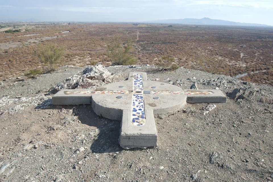
Initial Point in Arizona
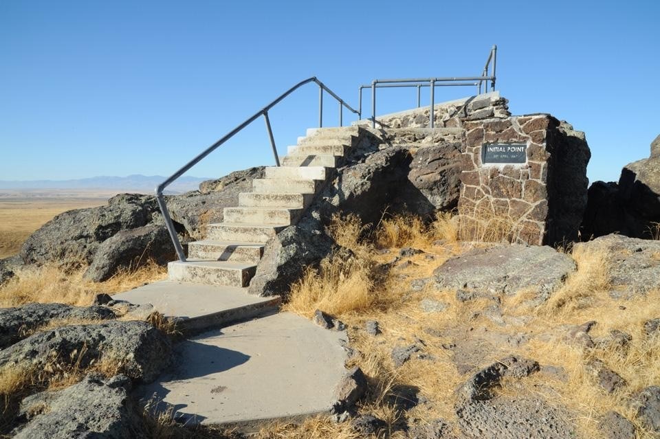
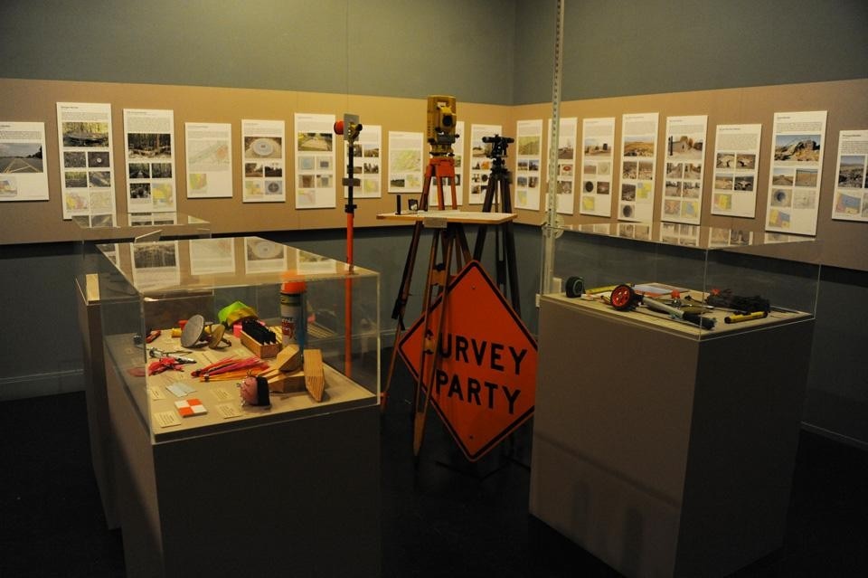
Along with photographs of the Initial Points and descriptive texts, on display are the actual tools (both historic and modern) of surveying. This is a show deeply aware of, or perhaps "in touch" with place, and yet it is perceptively detached from its connotations. In cold prose, it tells of Initial Points, which are protected by fences, buried in mud, sunk beneath swamps, vandalized, stolen, covered by manholes, isolated on top of mountains, forgotten, rediscovered, redesigned, and sometimes (sometimes) celebrated. And that, perhaps, is what makes the show most compelling: this delicate tension between information and implication.
Initial Point in Idaho
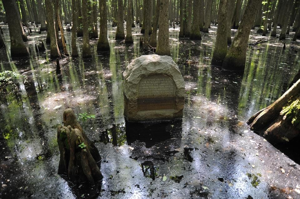
Take, for example, the panel devoted to St. Stephens Meridian in Alabama. Established in 1805, this Initial Point was used to survey the southern half of Alabama and the southeast corner of Mississippi. As noted on the panel, "The Meridian was located on a pre-existing monument known as the Ellicott Stone, which marked the 31st parallel in 1798 — an east/west Line of Demarcation established by treaty with Spain as the boundary between Spanish Florida and the rest of America to the north." Mind you, the exhibition gives no further information about the treaty, what lead to it, or what eventually made it obsolete; what the show does is provide a series of stunning photographs below that text, which depict the remote woods of Alabama where the historic Ellicott Stone can be found down a wild path that few frequent. The Stone, surrounded by bars as a method of preservation, looks something like a caged animal, captured on film as it is. In subsequent pictures, we see details of its recent repairs, and after that, a small segment of a map, to show the areas "denoted" by this small, largely unobserved symbolic marker. As much as Initial Points is about the concept and understanding of place, it is also about the architecture of symbolism: how do our words and symbolic markers build and define the physical spaces around us? To what degree is land and the way we understand it disputable? Although it goes without saying, it is still remarkable the extent to which science — in this case, the science of surveying — can be contingent on imprecision: the imprecision of our words, of our histories and the way they are told, and the "imprecision" of our fluid maps and geographies, which we know are subject to change.
Center for Land Use Interpretation, <em> Initial Points: Anchors of America's Grid </em> installation view. Photo by CLUI
Center for Land Use Interpretation, Initial Points: Anchors of America's Grid installation view. Photo by CLUI
Initial Points is not an art show; nevertheless, the photographs depicting the "anchors of America's grid" are emotive — perhaps despite themselves. They provide a cross-country tour; quiet visions of America from the mountains on its West Coast (i.e. Southern California's original Initial Point, which is established up the San Bernardino Peak, is a five hour hike for anyone wishing to see it) through its southwest deserts, and flat-topped hills, Midwestern planes and highways, swamp lands, and forests. Out of context, these images could form the foundation of quite a different show altogether. They capture, perhaps unwittingly, the expanse of the United States, the loneliness of its stretches, its untamable wilderness, the sodden summer skies that hang above its endless motorways. But then again, Initial Points is an exhibition precisely about staying within context — despite human error, despite the unpredictability of weather, or land, and the people who occupy it.
Louisiana purchase stone in Arkansas
CLUI itself is housed in an unassuming building off of a busy thoroughfare in West Los Angeles, sandwiched between the low-rise facades of dental care offices, restaurants, surplus stores, and anonymous storefronts. As part of Initial Points, the City of Los Angeles, Survey Division installed a new bench mark in the concrete outside of CLUI. Now the building is as much a point of reference as the exhibition inside. Curious, the history that will develop around it. Katya Tylevich

Initial Points: Anchors of America's Grid
The Center for Land Use Interpretation
Los Angeles
Through 15 April 2012
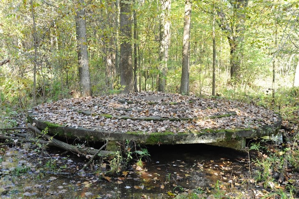
Initial Point in Southern Michigan
Initial Point in Navajo land
Initial Point in Utah

Latest on Architecture

Latest on Domus

Read more
China Germany India Mexico, Central America and Caribbean Sri Lanka Korea icon-camera close icon-comments icon-down-sm icon-download icon-facebook icon-heart icon-heart icon-next-sm icon-next icon-pinterest icon-play icon-plus icon-prev-sm icon-prev Search icon-twitter icon-views icon-instagram